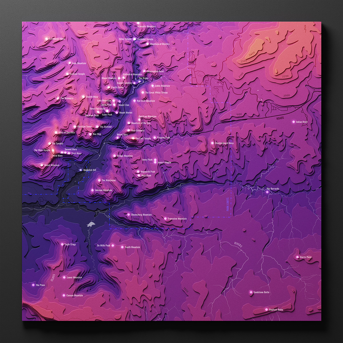
Z I O N
–––
Cartography
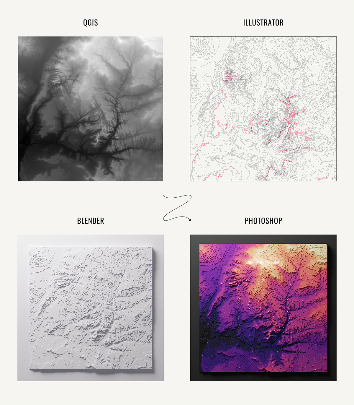
And so begins our journey through Zion National Park. In this collection of maps (main + four quadrants), elevation is represented as discrete layers (dark is low, bright is high). To craft these, I gathered and cleaned up geo data using QGIS and Illustrator, rendered stacked contours in Blender, and finished compositing in Photoshop. The project ends with a few pictures of my Zion adventures :).